 |
Cover photo:
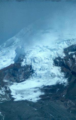
Mountain glacier, Chimborazo, Ecuador. Mountain glaciers can show us in one small area the whole glacier system from the snow-covered accumulation zone to the bare ice of the ablation zone. In this picture the lowest parts of the glacier and the surrounding land are covered with a dusting of snow. Note the proglacial moraine ridge at the bottom of the photo. For a few more photo's of the glaciers on Chimborazo and it's neighbour Cotopaxi, go here. |
|||
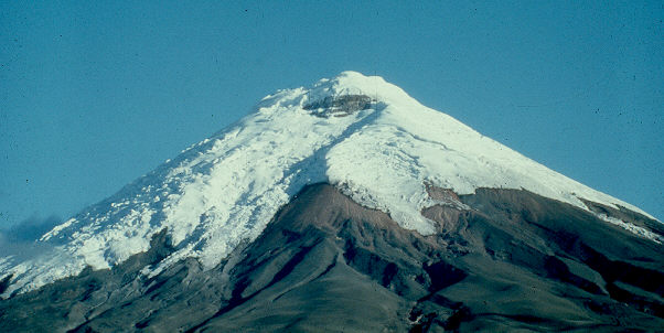 |
Fig. 1.1: The summit ice cap of the volcano Cotopaxi,
Ecuador.
Notice how the ice cap extends to a lower altitude on one side of the mountain because of a precipitation shadow effect. The side of the mountain facing the dominant moisture-bearing winds experiences higher snowfall and hence more extensive glaciation. Also notice the deep channels carved by meltwater and by volcanic mudflows (lahars) caused by melting of snow and ice during eruptions. |
|||
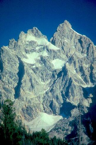 |
Fig. 1.2: The smallest scale of glaciation: Niche glaciers and ice aprons in the Grand Tetons,Wyoming, USA. Small glaciers such as these are often the most sensitive to local climate change. For a few more photo's from the Grand Tetons, go here. |
|||
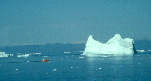 |
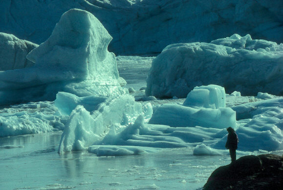
Fig. 1.3: A small iceberg in Disko Bay, near Jakobshavn, Greenland. The iceberg that sank the Titanic probably came through this area off the west coast of Greenland.
|
|||
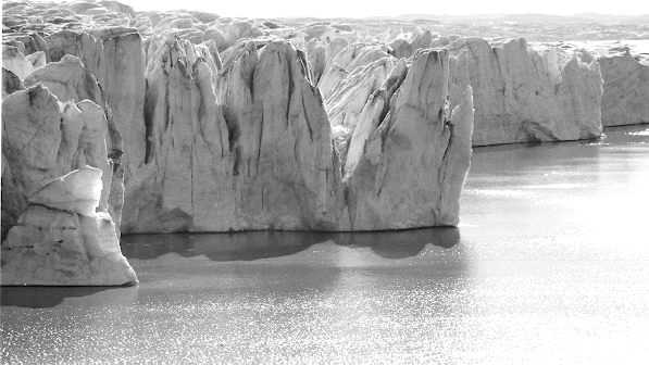 |
Fig. 3.5: A calving glacier front in West Greenland. The same ice cliff is shown in middle distance in figure 5.3, below. |
|||
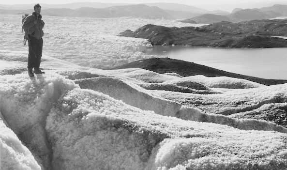 |
Fig. 5.3: Weathering of ice, Greenland. Ablation of the ice surface exploits the veins between crystals to produce a rough weathered surface, in the same way that weathering of a rock surface exploits joints and grain boundaries within the rock. |
|||
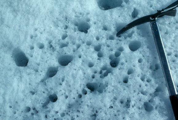 |
Fig. 5.4: Cryoconite holes. Small particles of debris on the surface of the ice absorb the warmth from the sun, warm up, and effectively "burn" their way down into the ice. Ice axe for scale. |
|||
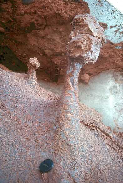 |
Fig. 5.5:
Ice pedestal. Where larger particles occur, the heat from the sun doesn't reach the ice beneath them, and while the ice in the surrounding area is lowered by ablation, the ice directly beneath the protecting rock remains unmelted, forming a raised platform on which the rock rests. This photo is from Cotopaxi, Ecuador, at a point where the sun strikes the glacier surface only around mid-day when the sun is almost vertically overhead. Lens cap for scale. |
|||
| Photo coming soon |
Fig. 5.6: Ice pedestal. This photo is from Greenland where the sun is low in the sky and the "shadow zone" stretches out northwards from the boulder. |
|||
| Photo coming soon | Fig. 5.7:
Dirt cone |
|||
| Photo coming soon | Fig. 5.8:
Dirt cone. |
|||
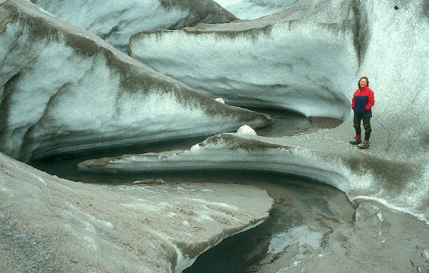 |
Fig. 5.9: Supraglacial stream. This is right at the edge of the Greenland ice sheet near Kangerlussuaq, at the snout of the Russell Glacier. |
|||
| Photo coming soon | Fig. 5.10:
Moulin. |
|||
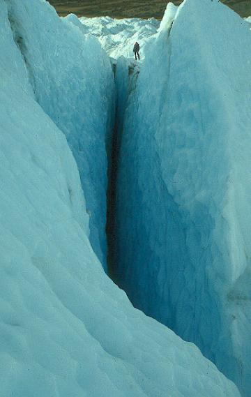 |
Fig. 5.11: Crevasse. Note figure behind crevasse for scale |
|||
| Photo coming soon | Fig. 5.12:
Crevasse patterns |
|||
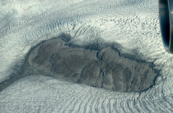 |
Fig. 5.13: Nunatak, crevasses and ogives |
|||
| Photo coming soon | Fig. 5.14:
Ice-bed contact: crystals and foliation |
|||
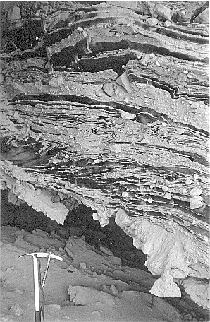 |
Fig. 5.15: Stratified basal ice. This photo is described by Knight, P.G. (1995) (Boreas 24, 11-12.) Abstract from that paper: The basal ice of many glaciers contains debris structures that reflect subglacial processes. Presented here is an unusually clear photograph of ice and debris in the lowest 2m of the basal layer at the margin of the Greenland ice sheet. The photograph shows ice-debris relationships and deformation structures that reflect entrainment processes and flow history. Also check out my "Beginner's Guide to Basal Ice" |
|||
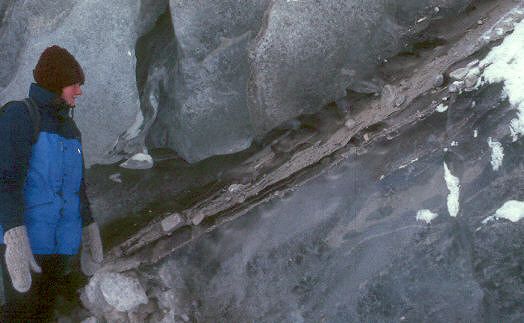 |
Fig. 5.16:
Debris band in basal ice. Debris in the basal layer can occur as distinct bands. These are often formed by freezing of material at the bed combined with compressive folding or thrusting in the basal ice. The ice close to the band appears ark because it is bubble-free. 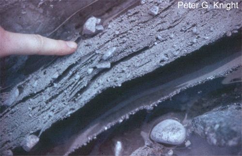 Here's a close up of the same band.
 |
|||
| Photo coming soon | Fig. 5.17:
debris aggregates in basal ice. |
|||
| Photo coming soon | Fig. 5.20:
The glacier sole in a subglacial cavity |
|||
| Photo coming soon | Fig. 5.21:
The toe of a subglacial cavity. |
|||
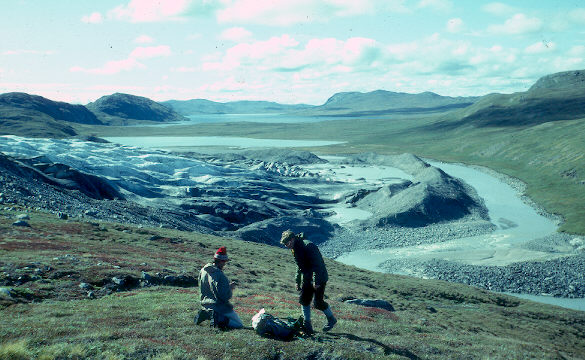 |
Fig. 8.1:
Glacier terminus and terminal moraine, Russell Glacier, Greenland. At present, many glacier margins stand behind moraine ridges that mark their former Little Ice Age positions. Here's the same view in winter, with all the water frozen.You can see my trail of footprints in the snow up the middle of the the river. 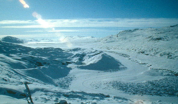 |
|||
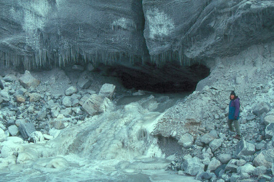 |
Fig. 9.6:
Water emerging from small subglacial tunnel. Yhis is the margin of the Greenland ice sheet near Kangerlussuaq (67N). Note figure for scale. |
|||
 |
Fig. 9.7:
Water emerging from large subglacial tunnel. This is Solheimajokull, an outlet glacier from Myrdalsjokull ice cap, Iceland. Note figure for scale. |